
I derived a lot of inspiration from the Direttissima write-ups and podcasts I listened to, so though I did not complete my attempt, what follows is my write-up in the hopes that anyone looking for more information or perspective on the adventure will find something!
The White Mountains Direttissima is any route connecting all 48 of the “official” 4,000-foot peaks in the White Mountains of New Hampshire. Though I only started trail running in the Whites in September of last year, I enjoyed the trails and adventures we had immensely. When I learned of this creative endeavor, I felt an inexplicable pull to try. What follows is my preparation, the attempt, and the aftermath.
Preparation
In November of 2025 I was fortunate enough to participate in the inaugural Mount Ascutney Vertical Backyard. The runner-up, who did hill repeats for 90 hours, was Bill Tidd, who has a blog about his adventures in the White Mountains. Perusing his blog, I found his write-up on an unsupported White Mountains Direttissima (he called it a “Velocissima”). I was intrigued to read about others doing it, but it didn’t seem like something I could physically handle.
Months later, in April 2026, on the bus to a New Jersey regatta with the rowing team, a From the Backcountry podcast popped up, and it was about the Direttissima. I had some racing plans for 2026 but not many, and this idea for a “project”/adventure rather than a race caught my attention. I was feeling strong and injury-resilient coming off many 100+-mile running weeks in January thanks to the Burrito League, and I wondered if I could do this White Mountains thing.
And so the route-planning began. Since I had limited experience in the Whites, I read and researched all I could about the trails, trying to figure out which ones were more or less technical, estimating whether a slightly longer less technical one would be faster or if I should just do the shortest route I could find. I really enjoyed trying to put together a route that maximized my own strengths (some road running, some steep hiking) and would have road crossings where I could get picked up and whisked to a hotel for actual quality sleep (my primary concern was managing the effects of sleep deprivation during a multi-day event on extremely technical terrain mostly alone).
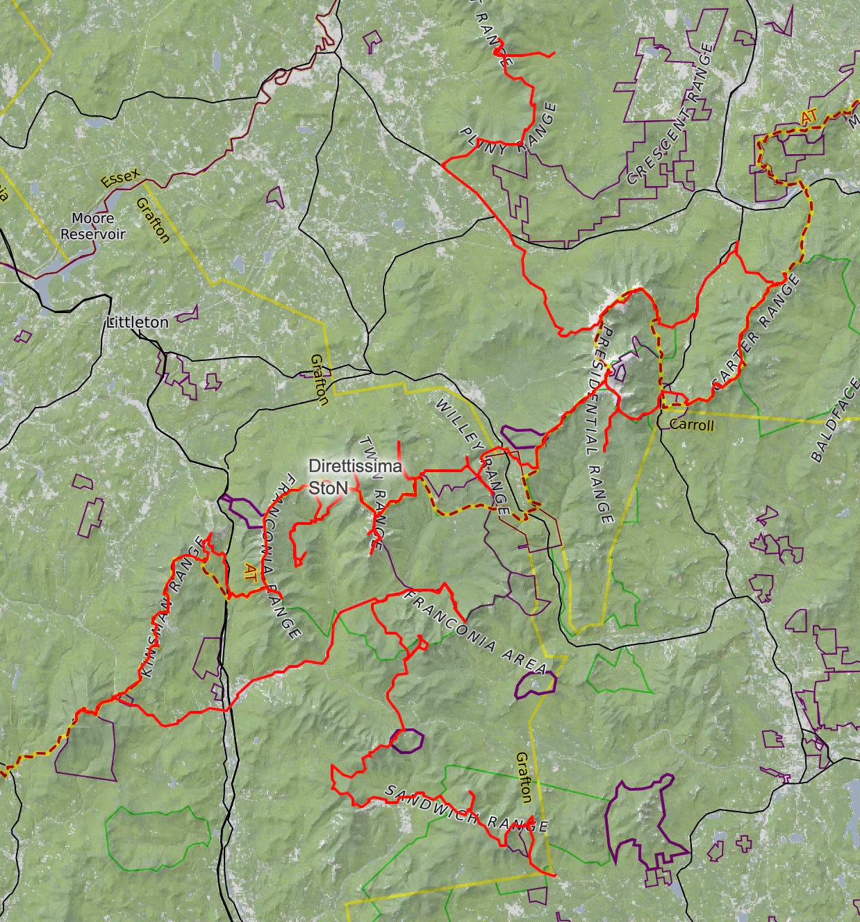
I spent hours creating and comparing routes, estimating times, finding out-and-backs where I could drop my pack, and overall trying to come up with the fastest, most adaptable, most exciting, and most reasonable route. This was the most time-consuming but also one of the most fun and unique aspects of this particular project. The final route gpx is here and pictured below. My Coros app put it at 233 miles with 78k feet of climbing and descending, and usually its estimates are a few miles and feet short of what actually happens 🙃
In terms of training, I had largely been running on smooth flat paved roads during the winter and spring in Boston. When trails cleared up, my weekends were occupied with coaching or the weather absolutely sucked. I got injured at the end of April while marathon training and took 10 days off running. When I restarted, I began doing Harvard stadiums in earnest. The big steps replicate big ledges in the Whites pretty well, both for going up and going down.
I also spent a lot of time on the bike and competed in a half Ironman in mid-June. This 6-week block of muscular focus was great, and in the remaining 4 weeks before my attempt in mid-July I shifted completely to steep trail running, spending some time in the Whites and some time in the Dolomites and Alps while on a pre-planned vacation. We arrived back from Europe the Sunday night before my Thursday morning start for the Direttissima attempt.
The sleep deprivation and GI disturbances that had accumulated from traveling were not the most ideal accompaniments for starting an attempt, but I really had no other option as we were planning to move to California the following week and friends had already committed to helping that weekend. In retrospect, I should have been more patient here. As the date grew closer, I also became aware that the weather forecasted rain and wind for most days. Feeling like I was really stuck to this window for the attempt, I was stubborn about not shifting plans. But I should have been patient and waited a few days for a better weather window. I can’t control the weather, but luckily I did have the flexibility of a few days to control when I started. It’s my fault I didn’t take advantage of that. When the project already had so little chance of success (and that’s partly why I tried!), I shouldn’t have further decreased the chances when I had control over that.
My plan was to start the route in the North and move South. I thought this would be better as I’d know the weather for the more exposed sections early. However, due to high winds in the Higher Summits forecast “60-80mph w/ gusts up to 95mph” when I’d planned to be up on Washington, I ended up deciding to run South to North. The wind looked like it might die down by later in the week and “hurricane force” wind (I swear it said that at one point in the prediction!) was just too windy for me to feel comfortable alone very far from tree line.
I went to bed with my heart beating fast. It had been working overtime for the past few days, likely in anticipation of all this. A little more sleep, and let’s get started.
The Attempt
Day 1. At promptly 3:28am, I started running from the car at Ferncroft Trailhead. I was actually so excited — it was happening! Finally!
I had never summited Passaconaway or Whiteface, the first two 4kers on my route, and I was looking forward to exploring those trails. As I headed up Dicey’s Mill, I turned on some music to dissipate my nerves and alert any moose of my whereabouts, though I truly wasn’t worried about any wildlife encounters.
There were so many frogs! I was following a stream, and I think it was frog heaven because I saw 1-3 frogs every step for the first few miles! I don’t think I’d seen that many frogs in my entire lifetime combined! I did nearly step on some. There were, of course, lots of fun cobwebs to break, and the moths adored my headlamp. As soon as I could turn my headlamp off, I did. The sunrise heading up the first mountain was beautiful, and there was a nice partial view to the northeast, where I was headed, at the top. It was a bit hazy, which I wasn’t surprised by given the poor air quality we’d been experiencing for the past few days due to wildfires in Canada. I expected the air quality to be acceptable today, nothing to stop me (even with mild asthma), and the forecast had predicted the smoke would clear out by the next day anyway. But, let’s refocus on today.
I passed a group of campers soundly asleep and hastened to turn off my music, but I was afraid I’d awoken them. When I looped back around past the campsite after summiting, the campers were awake and I apologized for the racket earlier, but they seemed confused so maybe I didn’t wake them up after all.
Onto Whiteface, I was pleasantly surprised by how tame these trails were. I was making good time. I think I did a little extra at this point because I wasn’t sure where the summit was, but in retrospect I think it was marked by a pile of rocks that I thought maybe marked some other summit. Anyway, I found my way onto Kate Sleeper trail, which was surely a sleepy trail. It was decently runnable, if rugged, and I saw no one. After a few ups and downs I came to the South Slide of the Tripyramids and made my way up to those peaks without any issues. On the descent I kept reminding myself, safety first, you can’t continue if you get hurt, and also, quick feet, like in the Dolomites. It was a steeper, rockier, longer slide than I’d remembered from the first time I’d done this trail last year, but I knew the reward was a nice smooth fire road to the parking lot where Kevin was waiting for me! I was also about an hour ahead of schedule at this point, so I didn’t feel rushed. The trails so far had been less technical than I’d anticipated in my calculations.
I dropped my pack at the car and headed up Tecumseh with a nice light waterbottle and 100 grams of carbs. The climb was nice, the descent a bit longer than anticipated, and when I hit Tripoli road it started to rain. Half a mile later I met Kevin at the Osceola trailhead and jumped in the car to avoid the downpour. Luckily it was a short downpour, and I used the time to change my socks, hydrate, and re-stock my pack. I set out again in a light drizzle, enjoying the climb up Osceola. I started encountering more people here, including a group that looked like a girls camp, and that gave me a little boost. But I also had my first more significant low as I neared the top, head spinning a bit and feeling nauseous. I was peeing maybe once an hour, pretty clear, and that gave me pause. Usually I didn’t pee that much. Maybe I wasn’t eating enough salt to hold onto my hydration. I decided to slow down and was rewarded with feeling better as I neared the next peak, East Osceola. I’d never descended East Osceola, and it was a bit more technical than I’d anticipated! But I made it down, traversed a wet Greely Ponds trail, and emerged onto the Kancamangus highway in howling wind and drenching rain. Luckily I only had less than a mile to go to get to the car, but it was pretty miserable running in the gut of this road as cars (and trucks) sprayed by me. Anyway, I made it to the car, and, in a low mood, switched out my pack and stocked it with fuel, forgetting a bit about the salt thing. As I was stomping out, not looking forward to this next, desolate, lonely, wet, 30-mile section, Kevin stuffed an extra 90 gram Precision gel in the back of my pack.
A few official-looking people wearing orange vests greeted me at the Hancocks trailhead and asked me if I was going to run up now? I said yes, pointed to my pack saying I have emergency gear, and continued on. They had no idea where I’d been or where I was going…
The trail to the Hancocks was a mess. It didn’t matter that I’d changed my socks. My feet got wet immediately. Basically every step was a puddle. It was sort-of choose the puddle or choose the slick root! Eventually I made it to the split for the Hancock loop. I draped my pack high over the trail sign, hoping it was out of reach of animals, and set out on the loop. I really tried to control my effort on the uphill here, as it was very steep, and I think I did a good job conserving energy. Luckily my pack was still there when I returned. I put it back on, gosh it feels like 20 pounds (it was probably 10 or so), and moved on. My last summit of the day, Carrigain, was about 15 miles ahead of me. It’d be 10 more from that summit to the final trailhead where I’d meet Kevin to go to the hotel. Bringing myself back to the present, I made the best time I could down the muddy, rugged Cedar Brook Trail to the Wilderness Trail where I began the Carrigain ascent. At the Hancocks parking lot, concerned about the weather and my stamina, I’d told Kevin I might not make it to Carrigain today and would let him know my decision and timing as I got closer. As it was still daylight when I hit the Wilderness Trail, and I felt I was making good time (side note: time is so weird) and had enough fuel, I decided to go for Carrigain.
Now, I had never felt this much trepidation ever before on trails. I was definitely more purely scared trying to scale the North Tripyramid Slide last year, but this was a deeper fear. I’d never done these trails, it was getting dark, it was windy with who knows how much exposed trail ahead, I was still feeling a bit iffy (mostly nauseous, still peeing a weird amount, but I’d also just felt the impending doom of a bonk and needed to take the entire 90 gram Precision gel Kevin had stuffed in my pack), my phone was losing battery too fast so I had no distractions, and it was so desolate (I hadn’t seen anyone since the trailhead and had a feeling no one was out here today). I tried to think instead about the next step forward, staying safe, and taking care of myself with hydration and fueling the best I could. After all, thru-hikers are out by themselves in these situations all the time (granted, they aren’t necessarily pushing as hard and have the ability to set up a camp). I drew inspiration from Amber Constant pushing through so many conditions on her year-long vert record attempt.
Darkness fell as I was going up the last 1.5 miles and 2400 feet to the summit of Carrigain, and there was some comfort in it. All I had to focus on were the rocks in the beam of light from my headlamp. Slowly but surely, trying not to think about what this steep descent would be like, I made my way up. And wow, I was rewarded with one of the best views I’ve ever encountered on the trails. The sun had sunk, leaving deep red outlining the mountains ahead. The rainclouds and haze had cleared, and the moon and stars were out in force. I climbed the fire tower, not sure if the summit meant I had to be at the top of that, and it was super windy but so worth it! Around 9:30pm I turned away and set back down the Desolation Trail to head to my final destination for the day. Luckily I had an uneventful jog/hike to the Lincoln Woods parking lot. I arrived around 1am and threw up my hands in celebration seeing the car in the parking lot. 21.5 hours, 63 miles, and 18.5k feet of climbing after I’d started the day, I was done, tired, happy, a bit nauseous still, and ready for some sleep.
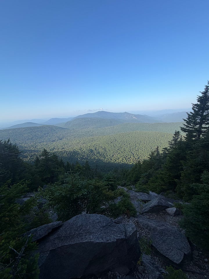
In reflection, I feel the entire first day took a lot of courage. It took a lot of courage for me to start this adventure in the first place, and it especially felt like it took courage to turn and start up the Desolation Trail to Carrigain at the end. I’m very proud of my execution and mindset throughout the first day and very much wonder whether I’d be able to replicate it if I were to attempt this again.
Day 2. I slept about 3-4 hours that first night and started my second day at the Lincoln Woods parking lot around 7:10am. I had a shorter day and in my head it was a bit of a recovery day between two larger days. I wore my pack for the first section, about 12 miles of road from Lincoln Woods to the Beaver Brook trailhead. In retrospect, I would try harder to travel lighter for this section. I didn’t really care at the time as I was feeling quite nauseous this morning and didn’t want to run very much, but next time I would suck it up better and figure out a better fuel-carrying situation, especially as I passed through downtown Lincoln about halfway in.
My route took me on a nice bike path I didn’t know existed and then onto a couple side roads that I thought were avoiding some construction but didn’t do much as the construction lasted 5 miles! They were repaving the road and it was quite a mess and smelly and cars were pushing me off the road once in a while, but just as well, this all made me want to get back on the trails. At the trailhead I met Kevin again, picked up a restocked pack, and was off. But oops! Two minutes later I realized I had forgotten to exchange my road shoes for trail shoes! Fortunately I had service, Kevin picked up the phone, and I ran back quickly to change. At this point in the day I was about an hour behind my estimated timing, partly because I’d started late but also because I’d done the road portion slower than I’d planned. Oh well, I can’t do much about it. Any forward progress is good timing. Beaver Brook trail up and down Moosilauke was a beast. It was very steep. My pack felt so heavy. I realized I was a bit sore from yesterday as well. At least it wasn’t too lonely though. I met a couple Appalachian Trail thru-hikers, one heading north-bound and one south-bound. I tripped once on the way up, catching my left toe on a rock and yanking on my left anterior tibialis. But after a few concerning miles that pain went away. On the way down, my knees started hurting. I needed to get down though, quickly, but safely, as two of my friends, Klara and Elle, were waiting to run the Kinsmans with me and I was already behind schedule.
As I crossed the last little stream toward the trailhead, I saw someone waving their arms and excitedly yelling my name. Yes! I would get some company now!
I did a shoe change as I felt I was getting some blisters and achey feet (definitely helped along by the wetness for so long the day before). My nausea had abated and I was finally hungry, so I ate a pita bread, Annie’s bunny crackers, Fig Newtons, and a bunch of lemon wafer cookies. Since the previous day I’d been subsisting on chews, gels, bars, drink mix, and a few noodles for dinner. I forgot to drink the protein shake I’d planned on at this stop though, oh well.
A picture later, we were off! They set a good pace up the first climb, a surge of excitement giving me extra energy. The Kinsman Ridge trail was much nicer than I’d remembered, and we had a good flowy time on our way to Eliza Brook. After refilling water there, we headed up the Kinsmans and then down to Lonesome Lake Hut via Fishin’ Jimmy trail, which was a bit technical, but honestly at this point nothing phased me. We stopped for a minute at the hut, I told a hut croo member there about what I was attempting, and set off up Cannon, aiming to make it for the sunset. And that we did! It was beautiful, and Franconia Ridge, where I was headed the next morning, was beautiful and formidable in the evening light. I couldn’t think that far ahead though. Alright, let’s go. Any pauses are eating into my sleep. With single-minded focus I tried not to feel regret for not lingering on the views. They had been plentiful and there were more to come. My friends could catch up to me if they wanted to spend longer up there.
With many oops, oofs, and ahs, we made it down Hi-Cannon to Lafayette campground and then along the bike path to The Basin, where Kevin picked me up for the night. (I’m so impressed with everyone who does this route unsupported and camps… I would never sleep!) Today I’d gone another 38 miles with 11.5k feet of elevation gain/loss. It was around 10pm, and, sorry I’d be disrupting their sleep, I texted Charlotte and Zack, the friends accompanying me tomorrow, that we should meet in the hotel lobby at 3am.
I stomached most of a burger and fries this night, which was a morale-booster. I visualized the nutrients going straight to my knees, which were still a bit sore from the descending.
Overall so far, during movement, I’d been averaging about 45-50 grams of carbs an hour, maybe 300-500 mL liquid an hour, about 200 mg sodium per liter, and a handful of protein through Naak and some Clif Bars (I’d intended to use Infinit but forgot it in the whirlwind between Europe and New Hampshire!).
Day 3. I was lagging a bit in the morning so we started about 30 minutes later than planned. Next time I could definitely improve my turnaround time from trails to bed and bed to trails. But at least we started! Had it not been for the friends waiting for me, I’m not sure I would have started either Day 2 or Day 3.
We set off up Liberty Springs trail around 3:30am. It was a slow slog as I warmed up, legs a bit heavy but thankfully not sore. We made it to the top of Liberty for a gorgeous sunrise that followed us to Flume and back. The breeze picked up as we traversed the ridge toward Lafayette, but there were a number of people out and about. As we were descending Lafayette, two hikers were ascending. I glanced up and was pretty sure I saw Will Peterson, a local legend, but I wasn’t positive, but then, unmistakably behind him, appeared Bill Tidd, another local legend and my first Direttissima inspiration! Woah, are you Bill Tidd? You know, some sleep deprivation and physical exertion can lower inhibitions… He responded with, Yes, and that’s Will Peterson! Hahaha… Cool! I’m Serena, I know you two from the Mount Ascutney Vertical Backyard! What’re you up to? They shared they’d camped at 13 Falls and were doing the ridge today. I shared I was doing the Direttissima, and they sounded genuinely interested! This gave me a huge boost, and I rode it all the way down to 13 Falls, where we were linking up with Lincoln Brook Trail to knock out Owl’s Head. Around this time I came to the realization that everything hurt — my feet, my legs, my knees, my shoulders, my back — and in that realization, nothing hurt. It was a very freeing feeling and an emotional spot I’d been hoping to reach during this adventure.
It was a tedious descent from Garfield down to 13 Falls Campsite, but the most soul-sucking part of the entire day (and adventure) was the flat, wet out-and-back along Lincoln Brook to Owl’s Head. It was just so miserable, and I don’t think any of us were enjoying it. It started raining. It was so frustratingly slow. I guess at the same time we were in it, and that’s, like, what I wanted. But we got very behind on timing. It’s too bad because I truly enjoyed the climb up the Owl’s Head slide and the descent down Brutus Bushwhack, but then the slow trek back to 13 Falls sucked any little joy I’d gained back out of me. In what had now become fog, we climbed up Galehead. I turned on some music, and we collectively felt that we were physically and emotionally climbing out of a well.
Unfortunately by the time we reached Galehead Hut we were about 3 hours behind schedule and still a bit low on morale. We filled water, I had some coffee cake, and we witnessed a Hut dinner gathering, which was a cute ordeal. It was around 5:30pm, and after some discussion about the weather and our physical states, we decided to cut our original day short. I was getting really cold, so I layered up and we headed out to climb South Twin, which certainly warmed me up! It was misty and gusty at the top, so we quickly began toward North Twin. The trees were so tight into the trail here that my arms and legs got soaking wet brushing on all the pines. I even almost donned the full-on rain pants I’d packed!
As I’d explored the route options for the Direttissima I’d also read about some of the other surrounding trails in case we did have to bail or change plans. I was pretty sure the descent from North Twin to the road was long and chill, and it was, but emphasis on long. Around halfway down I managed to get some service and call Kevin, so I updated him on our plans (though I was carrying a Garmin inReach it doesn’t transmit messages well under tree cover). It felt like forever until we finally saw a headlamp in the distance and emerged in the North Twin parking lot to greet him, around 10pm. Thankfully, Kevin had found a little hotel/house for us to stay in that night that was pretty close by. I’m really very impressed and grateful for the support he provided at all times of day and night throughout this quest!
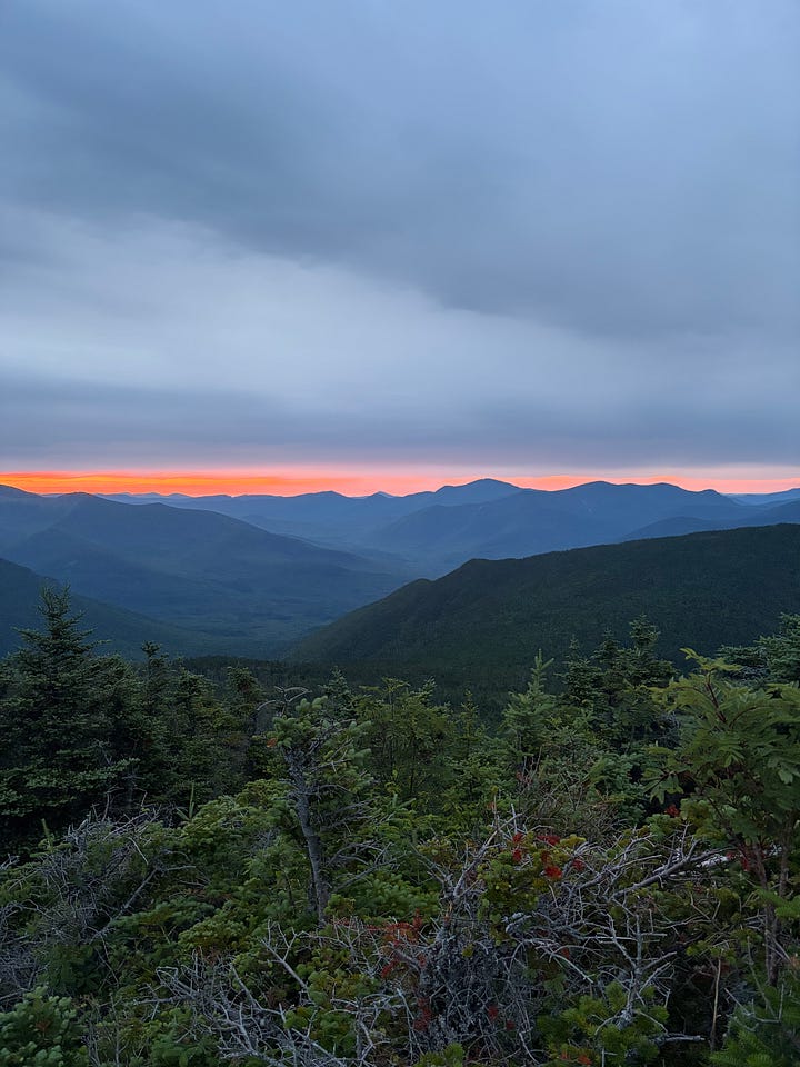
Day 4. Given the weather forecast with high winds, I almost didn’t start this day. But, I felt like I really needed to attempt. I needed to at least try. So, after a good amount of sleep (I think I got 5 or so hours this night), I started from the North Twin parking lot up Mount Hale, alone. My plan was to finish off the peaks we hadn’t hit yesterday. I was actually feeling really good at the start. I had applied some tape to my feet over the gnarlier blisters and that seemed to help with the foot pain. (Also, toe socks are awesome!) I was even thinking that I would make pretty good time and perhaps even be able to traverse the Southern Presis to Pinkham Notch to make up some time on the day before (that was the original plan for my morning of Day 4). But, I reigned myself in and refocused on the present. First, I had to bag the Bonds. I made it without issues over Hale and up Zealand. But I was getting a little nervous about the wind and my head started hurting, perhaps due to nerves or maybe sleep deprivation. It seemed like a good time to take a little Tylenol, so I did, and I think it helped the headache. I think this was the first time I’ve ever actually took any medicine while out on trails. On my way up Zealand I encountered a few trail runners who told me I was making good time and wished me luck up on the Bonds but said they were saving those for a better day. I didn’t meet anyone who was heading up to the ridge, but I did say hello to a couple coming down from Guyot. This made me a little more optimistic that I might be able to traverse the exposed rocky section I knew stood between me and the Bonds. I put on my layers and ascended into the increasing wind and fog. With the low tree line it was certainly windy but manageable for a while. But then the trees completely disappeared and I was exposed. A solid gust came and knocked me to the ground. I took the video below while sitting on the ground, deciding that I was too uncomfortable moving forward and would be unable to do the Bonds.
I think I said something about the wind in this video and not being cold or afraid of cold, just uncomfortable with the wind… perhaps I should’ve turned around and tried again an hour later when the sun came out… it was still windy though, I could see trees uprooting on my descent… I’ll never know what I should’ve done, but this is what happened.
So I turned around and crawled back to the tree-lined section of trail. I stood there for a few minutes, debating if I should try again or give up so easily. Ultimately I turned around and left the Bonds for another day. Descending Zealand sucked. I was half-sobbing half-cursing but also trying to look happy as I passed other hikers on their way to Zealand (a protected summit). Eventually I made it down and stopped by Zealand hut to refill water. I also took a pause at Zealand Pond to just slow down and appreciate the hike for what it was, then I turned and climbed the AZ trail to Tom, traversed Field and Willey (at this point I was thinking perhaps I’d continue and just do the Direttissima without the Bonds, plus I didn’t want to completely ditch my day and this extra trail might let me process it all), and then descended a rough Avalon Trail to Crawford Notch. I’d made good time today despite it all, and when I was done I ate an entire large pizza. In the last day and a half, I’d gone a final 61 miles and 23k feet of vert, bringing the total for the attempt to 163 miles with 53k of elevation gain.
After the pizza I decided that I wouldn’t continue my attempt. Adrenaline is a heck of a drug and had kept me driven so far, but it was wearing off. Tomorrow we’d drive to the beach to meet up with some family members, eat ice cream, and decompress from this whole ordeal.
The Aftermath
I’ve tried to put my finger on what about wind makes me so uncomfortable. It wasn’t supposed to be raining while windy, so it wasn’t the slipperiness. I had layers, a hat, gloves, and an emergency blanket, so it wasn’t the cold. I’m not totally sure what made me hesitate in the end. Perhaps managing the wind was a different sort of unknown that I just didn’t feel ready to dive into. Images of myself being pushed against sharp rocks, losing my footing, getting injured and turned into a Northeast Explorer story, were too powerful for me to push through. I vaguely thought maybe the wind would blow rocks or branches into me and hurt me that way. It’s possible that some sleep deprivation and overall body aches and, despite my efforts to separate emotions from weather, the weather itself, were influencing how I felt and therefore the actions I was willing to take to keep going.
Four days after finishing my feet and knees have finally shrunk back to their normal size and no longer hurt. Some extra sleep has improved my memory. I feel better integrated back into real life. In another week I’ll turn my sights towards the next adventure. Another attempt on this might happen next year, or maybe in 10 years, but I do think I’ll try again.
I learned a lot about the laser focus, the constant forward motion, and the presence required to do multi-day events, when operating on a clock. Of course my main goal was to finish this route, and I’m disappointed I did not. But my other goals about seeing what would happen, which body systems would struggle, and how fueling, hydration, and sleep would impact my movement, were mostly fulfilled. Did you know you can last four days on chews, gels, and Cheez-Its, and still not be tired of them?
P.S. Happy to hear if you’re interested in attempting this route or something similar — I’d love to help out if I can!